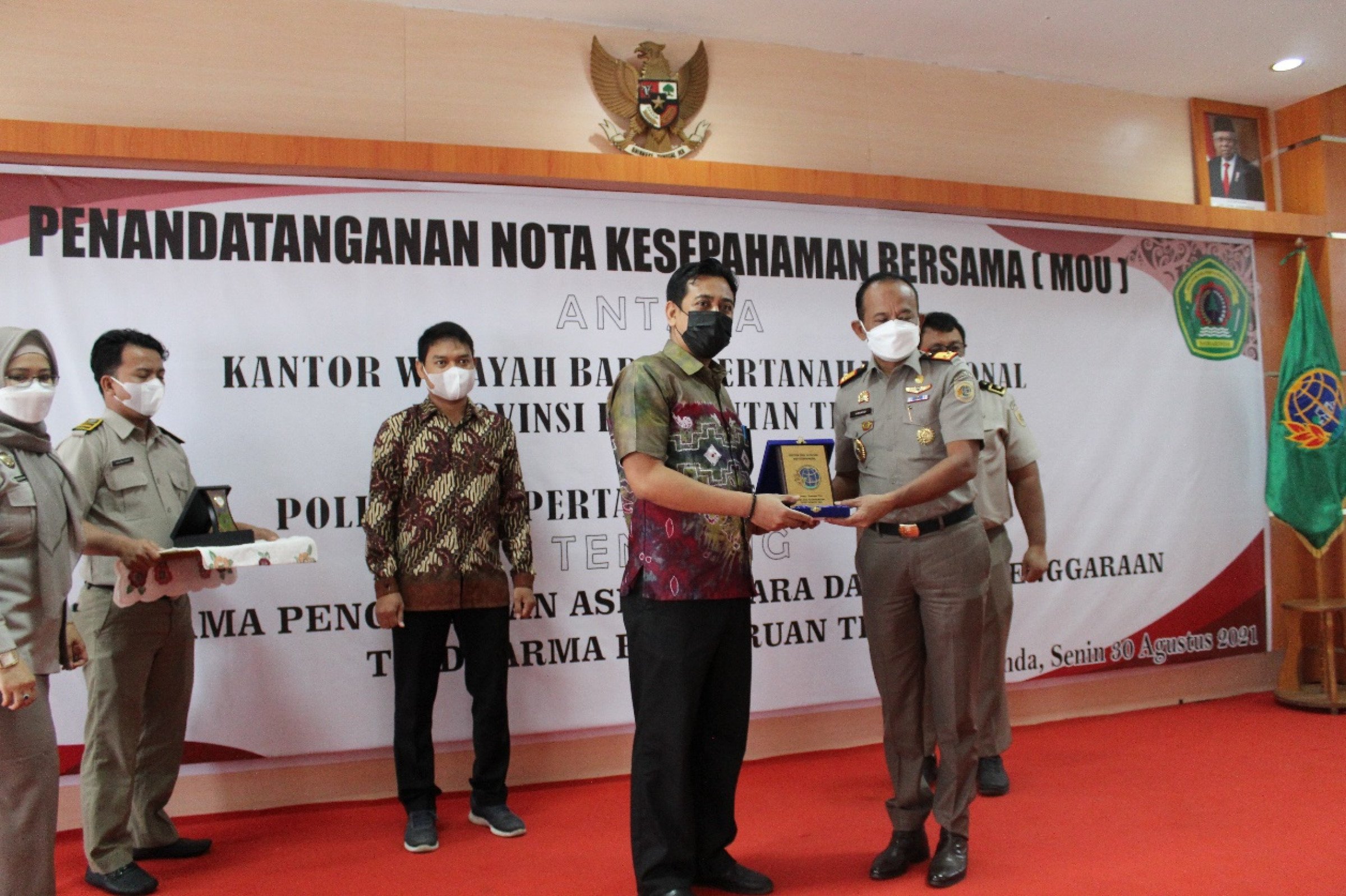
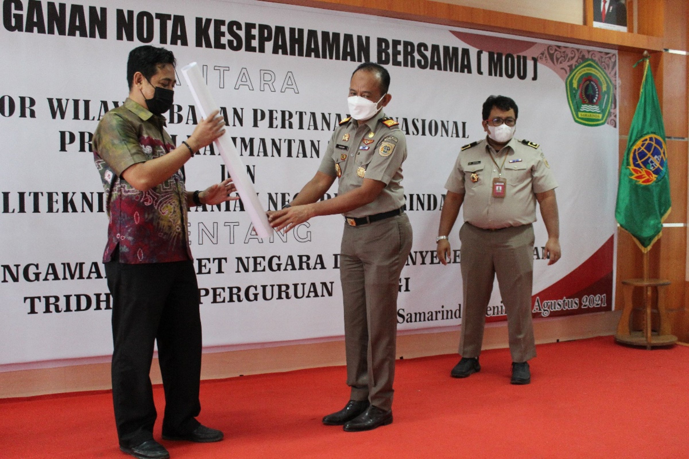
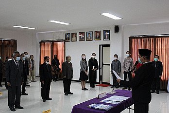
Director of the Samarinda State Agricultural Polytechnic (Politani Samarinda) Hamka signed a memorandum of understanding (MoU) with the Head of the Regional Office of the East Kalimantan National Land Agency, Asnaedi. This activity was also attended by Wadir II Eva Nurmarini, Deputy Director for Cooperation Yulianto, Head of Public Relations Politani Andi Lisnawati, Head of Geomatics Technology Study Program, Dawamul Arifin, Dwi Agung Pramono, and Sato Hambali the practice of the Tridharma of Higher Education which includes Education, Research and Community Service. In addition, on the same occasion, there was also the signing and submission of the Politani Land Map at the Regional Office Hall of the National Land Agency (30/08/2021).
The Samarinda State Agricultural Polytechnic and the Regional Office of the National Land Agency of East Kalimantan Province carried out the Memorandum of Understanding which will then be followed up with a cooperation agreement (PKS) to improve data quality at the Land Office in East Kalimantan and North Kalimantan (Kaltimtara) which will ultimately have an impact on improving the quality of land services for the community. Cooperation that is focused on mentoring and supporting human resources. “The support of skilled human resources for surveying and mapping for data validation and quality improvement is expected to be able to answer the challenges of resolving and improving data quality at BPN that is better, more valid and accountable. Asnaedi said
With valid data, it can help accelerate the implementation of land acquisition for the public interest, provide good services to the community and accelerate the movement and economic growth of the community. Asnaedi said. Meanwhile, Hamka in his speech expressed his highest appreciation to the Head of the East Kalimantan Provincial BPN Regional Office for being given the opportunity to collaborate, Hamka in his presentation said that Politani is currently moving forward with study programs such as Geomatics technology and Software Engineering Technology (TRPL). demanded by the market. Politani Samarinda will later become the Center for Excellence in Technology for Surveys and Mapping in East Kalimantan, due to the success of the Politani Geomatics Technology study program receiving a grant from the Ministry of Education and Culture. he said.
"As one of the Vocational Colleges, Politani Samarinda is here to produce skilled and work-ready workers, with this collaboration and synergy, it can improve the quality of Human Resources, both students and lecturers. Hopefully many Politani alumni will be absorbed and included in mapping activities or other activities at the Land Agency, because all learning processes in the future will go into the community or agencies, so they need guidance, because in principle campuses can progress, campuses can be empowered, students and alumni can become professionals if there is a bond of cooperation with industry (Humas/AL).
-thumb.jpg)
-thumb.jpg)